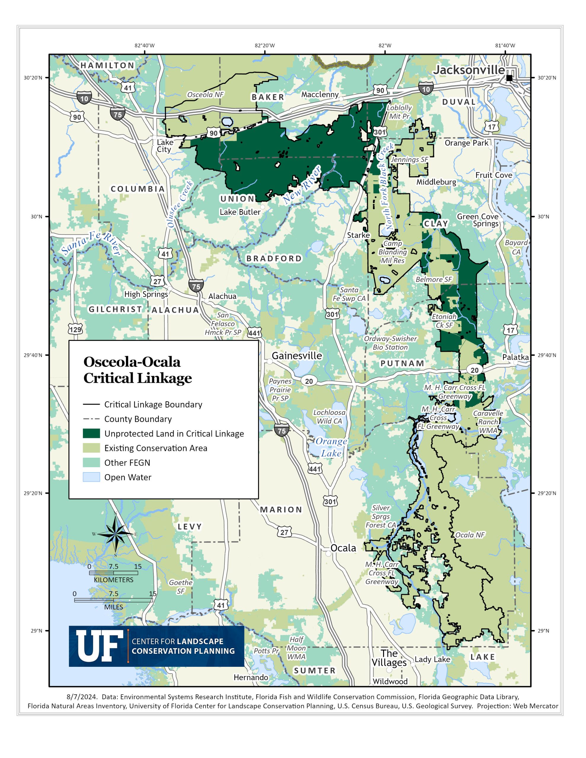
The Ocala – Osceola Critical Linkage
The lush green forests and brilliant blue springs of the Ocala-to-Oceola (O2O) Critical Linkage create a vibrant blue-green network across North Florida. Further protection in this linkage is essential in connecting central priority one land through Ocala National Forest, Camp Blanding Joint Training Center, and Osceola National Forest to priority lands towards the panhandle and northward into Georgia.
The O2O is home to over 16 endangered and threatened species, including multiple “umbrella” species; species that are especially important in making conservation-related decisions because their protection indirectly protects many other species within the natural habitats the landscapes they are found in. The Florida Black Bear, Southern Fox Squirell, Striped Newt, Gopher Tortoise, Red Cockaded Woodpecker, Florida Scrub Jay and Sand Skink are examples of these species found in the longleaf pine, sandhill, scrub, mesic flatwoods, marshes and swamps of the region. The linkage also offers ideal potential habitat for future panther populations north of their existing range. Much of the state’s highest priority lands for biodiversity, landscape integrity, rare species habitat and potential habitat richness falls within the bounds of the O2O.
Extensive timberlands make up over 53% of the unprotected land between the national forests, military installations and other protected lands in the area. In addition to providing habitat and corridors for many of the umbrella, endangered and threatened species, these working lands also provide ecosystem services such as timber production, carbon sequestration, and aquifer recharge; a critical consideration as this region is home to many of the state’s outstanding springs. They can often be operated as a less intensive commercial land use in comparison to intensive agriculture or development that is not compatible with the ecosystem services current timberlands provide. The majority of the state’s Florida Natural Areas Inventory (FNAI) identified sustainable forestry lands, existing and former pinelands with the potential to be managed to mimic natural pineland habitat, lie within the linkage.
The almost 100-mile-long critical linkage spans six major north and central Florida watersheds within the Floridan Aquifer. Countless springs, from first magnitude springs like Alexander Springs to small, ephemeral springs, that come and go with the seasons, are scattered throughout the O2O. The springs, riparian corridors, wetlands, lakes and other hydrologic components in the region are not only important for protecting the quality and supply of the state’s drinking water, but also act as habitat for many endemic, and endangered species and habitat and corridors for countless others. Millions of tourism dollars come from the recreational, hunting and fishing activities centered around the rivers an springs within the O2O.
As a sentinel landscape, or areas where conservation areas, working lands, and national defense interests converge and collaborate to further conservation and military goals, the U.S. military play a critical role in not only the protection but active management of high-quality habitat that acts as buffer to military installations. Over 25 other federal, state and non-governmental organizations are responsible for the management of the protected lands in the linkage. Future protection is heavily dependent on building relationships and collaborations with working land owners between the preserved hubs.


Unprotected Land Cover Maps for the Ocala-Osceola Linkage
The future of the linkage is dependent on the protection of currently unprotected land within this FEGN / Florida Wildlife Corridor priority one region. These maps provide a breakdown of the types of unprotected land cover in the Ocala-Osceola linkage.