The Florida Ecological Greenways Network
The Florida Ecological Greenways Network (FEGN) is a statewide database that identifies and prioritizes a functionally connected statewide ecological network of public and private conservation lands. The FEGN guides the Florida Office of Greenways and Trails (OGT) ecological greenways conservation efforts, and promotes public awareness of the need for and benefits of a statewide ecological greenways network. It is the primary data layer used to inform Florida Forever, Rural and Family Lands Protection Program and other state, federal and regional land acquisition programs regarding the most important ecological corridors and intact landscapes across the state for protection of Florida’s native wildlife, ecosystem services and ecological resiliency. It is also the key layer providing the science foundation for the Florida Wildlife Corridor.
“The FEGN is the key layer providing the science foundation for the Florida Wildlife Corridor.”
The FEGN database was created and is maintained by Center staff. Tom Hoctor, Center Director, has led the creation, revision and implementation of the FEGN since its inception in 1995, including policy work to support protection of the FEGN with multiple state federal, regional and NGO partners. Key project partners include the Florida Natural Areas Inventory, Florida Conservation Group, and Florida Wildlife Corridor Foundation, advisory group members who provide technical assistance and state agencies and foundations who provide technical assistance and funding.
Florida Wildlife Corridor Day 2024 at the Florida State Capitol.
Image Credit: Alex Freeze
One of the goals of the state greenways plan is to update the FEGN base boundary and priorities approximately every five years. The most recent update to the FEGN was completed in 2021, and additional updates are underway.
Primary goals of the update include:
- Revise priority areas important for biodiversity conservation based on new or updated data.
- Expand considerations of ecosystem services.
- Incorporate additional ecological connectivity models and ensure functional connectivity to other states.
- Address potential sea level rise impacts on FEGN priorities.
- Conduct boundary edits and data updates throughout the state.
FEGN Online Tools
The HUB: a central place to learn about tools, data and other online resources
The UF Center for Landscape Conservation Hub is a central source for online tools, their tutorials and other data the center provides.
Featured Web Applications
The FEGN Viewer
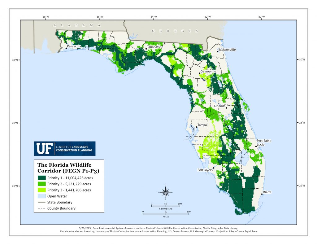
The FEGN Map Viewer is designed to provide users access to the prioritized statewide Florida Ecological Greenways Network. Together with the FEGN (2021 edition) data layer, users will find existing and proposed conservation lands, growth projections, political boundaries, sea level rise projections, and several reference layers. The top three priority layers of the FEGN have been designated the Florida Wildlife Corridor (Senate Bill 976). The Florida Wildlife Corridor data layer is also included.
The FEGN Dashboard
The FEGN Dashboard allows users to explore opportunities and challenges associated with FEGN protection. Users can explore development trends, regional statistics for protected and unprotected land, and more.
The EcoCon
The Florida Ecological Connectivity Planning Viewer, or EcoCon, is a decision-support tool designed to aid in the planning and protection of ecological connectivity and conservation priority areas across Florida. It allows users to evaluate natural resources, explore over 140 conservation-related data layers, and search specific sites by county, district, or parcel. With pre-set data suites targeting themes like connectivity, conservation status, development threats, and land ownership, users can perform basic spatial analyses, import their own datasets for comparison, export data, and generate custom maps for printing and sharing.
Understanding the 5 Priorities of the Florida Ecological Greenways Network
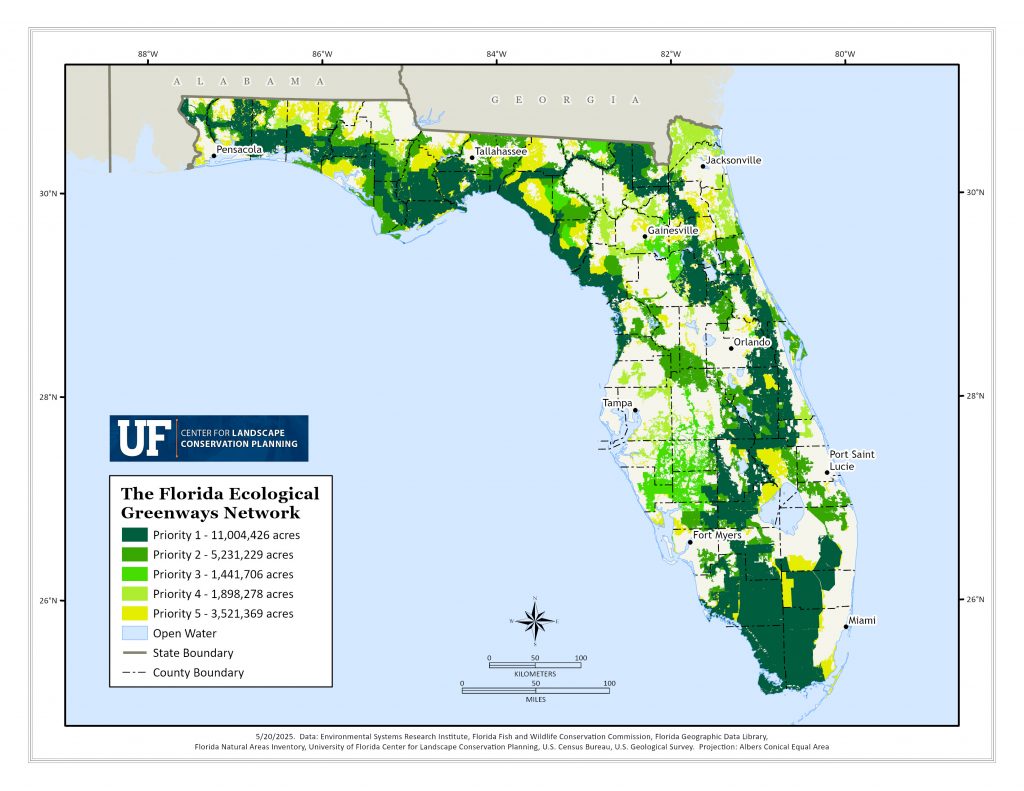
The Florida Ecological Greenways Network (FEGN) includes both existing protected areas and high-priority opportunity areas for conservation, organized into five priority levels that together form the foundation for a connected statewide ecological network.
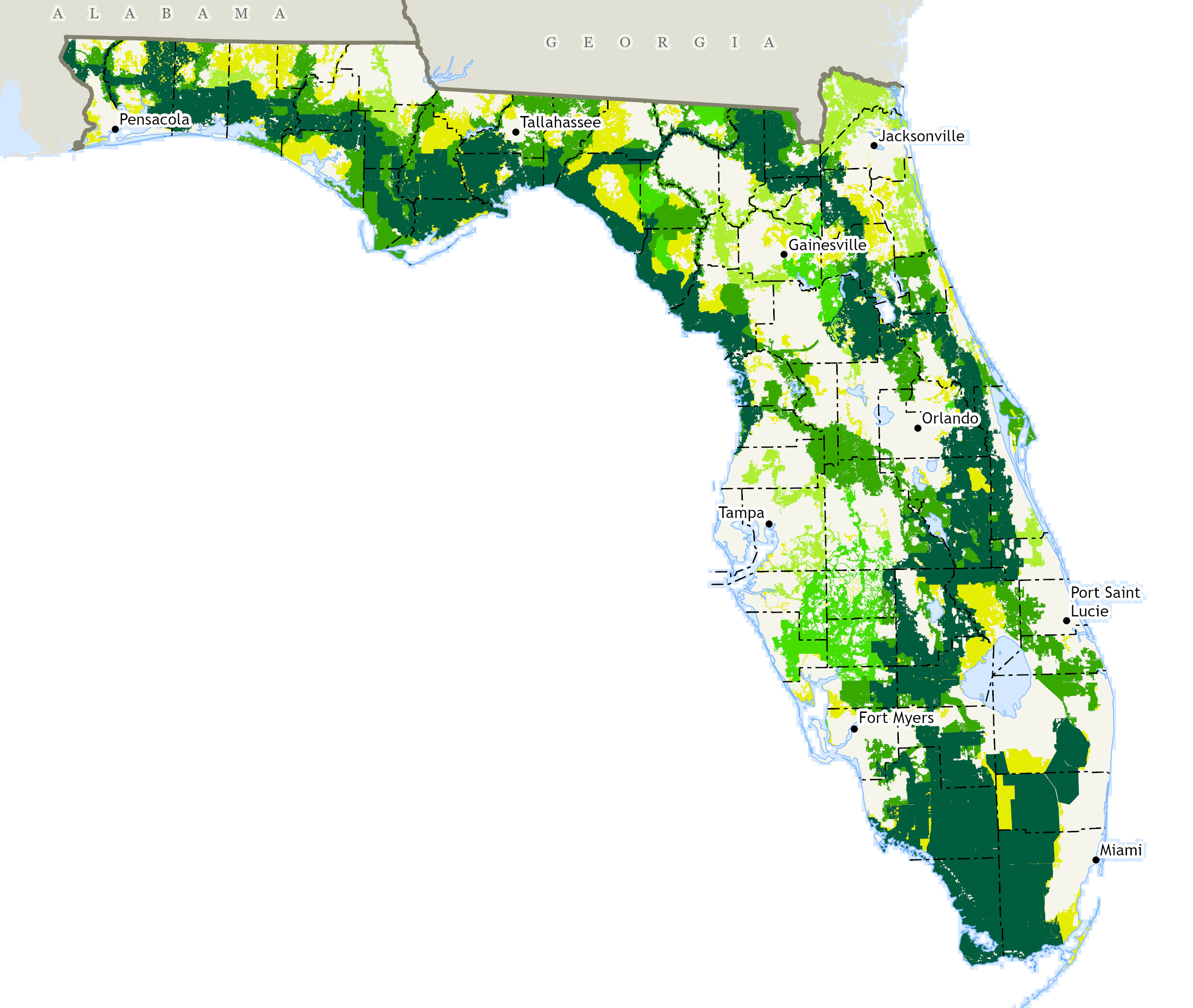
Priority 1
Priority 1 corridors (Critical Linkages) are essential for completing a functionally connected statewide network of public and private conservation lands across the state.
Priority 2
Priority 2 corridors are often supporting areas surrounding Critical Linkages that help protect a wider and potentially more functional corridor. In some cases, they are additional corridors connecting to other important areas of the state that could significantly contribute to a statewide ecological network.
Priority 3
Priority 3 corridors provide significant alternate routes to Critical Linkages, with the goal of providing functional alternatives where available in case a Critical Linkage cannot be protected.
The geographic boundary of the Florida Wildlife Corridor is defined by Critical Linkages 1 – 3 of the Florida Ecological Greenways Network (FEGN).
Priority 4
Priority 4 corridors provide important riparian corridors or represent other regionally significant opportunities to protect large intact landscapes.
Priority 5
Priority 5 corridors include all other areas of large intact landscapes that support protection of a statewide ecological network.
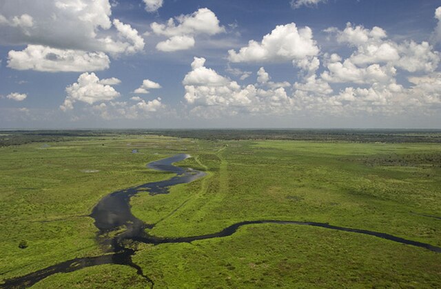
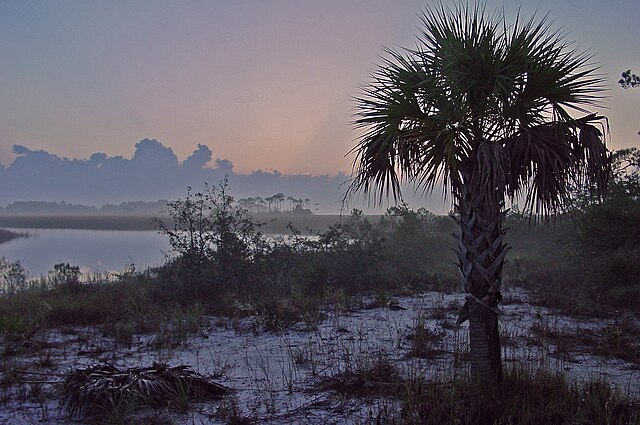
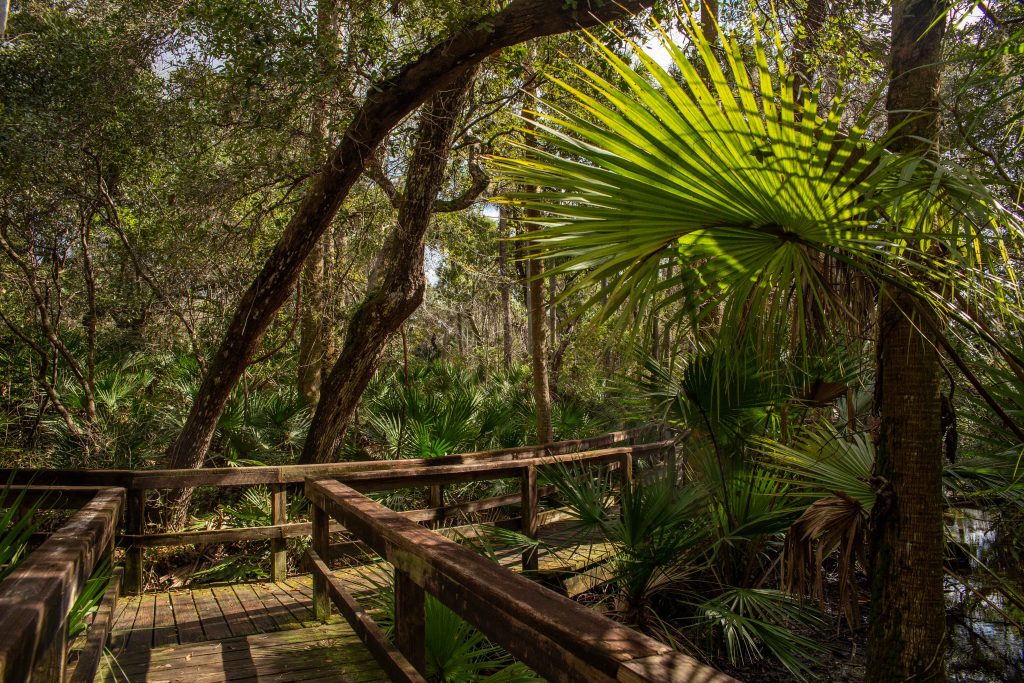
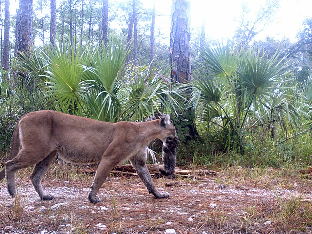
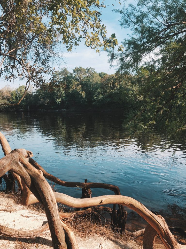
The FEGN is a “greenprint” that identifies high-priority opportunity areas for a statewide ecological network, but conservation doesn’t end there. Vital habitats exist across our state – protected and unprotected alike. These areas are essential for local wildlife corridors, providing clean air and water, protecting biodiversity and enhancing community resilience.
The Critical Linkages of the Florida Ecological Greenways Network
Priority One lands represent the highest strategic value; their protection would link nearly all of Florida’s largest conservation areas. These lands form the backbone of the Florida Wildlife Corridor, which is composed of FEGN Priority 1–3 areas.
Within Priority One, the unprotected lands known as Critical Linkages are especially significant. These areas, if conserved, would close key gaps in the statewide network and secure functional connectivity. The Center for Landscape Conservation Planning has identified ten such linkages across Florida, each with distinct ecological, cultural, and historical importance. Together, they represent the most strategically important areas for maintaining the integrity of the Florida Wildlife Corridor.
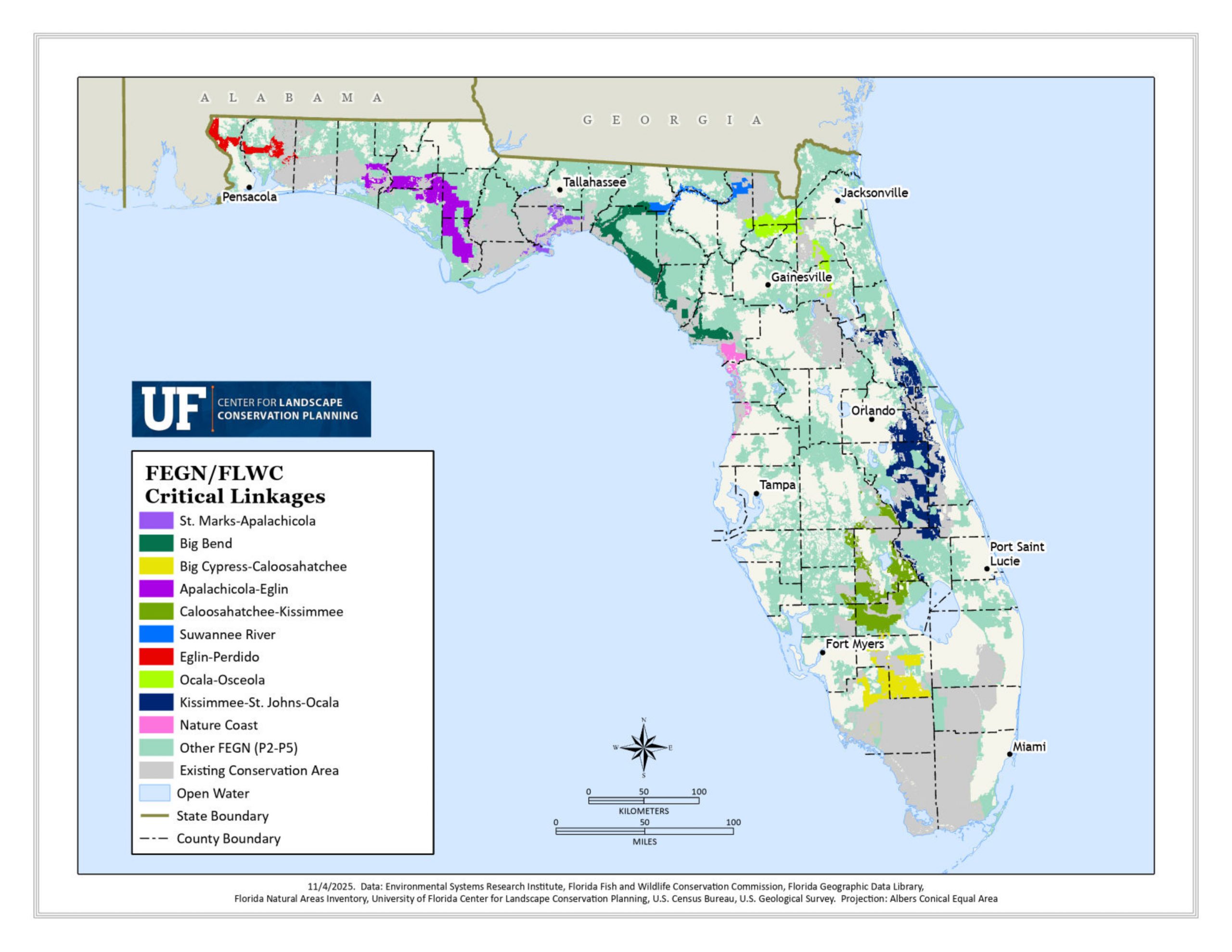
Learn more about each critical linkage
Every critical linkage holds its own unique ecological, cultural, and economic value. From distinct habitat types to specific land-use pressures, each plays a vital role in Florida’s greenway network. Click any of the Critical Linkage profile page links below to discover how these connections sustain our state’s vibrant, connected landscape.
Reports, Downloads and Maps
FEGN 2016
Critical Lands and Waters Identification Project (CLIP) 4.0 Technical Report
FEGN 2013
The previous complete update of the FEGN base boundary
2021 FEGN Priorities 1-3 (The Florida Wildlife Corridor) Data Download:
2021 FEGN Priorities 1-5 Data Download: