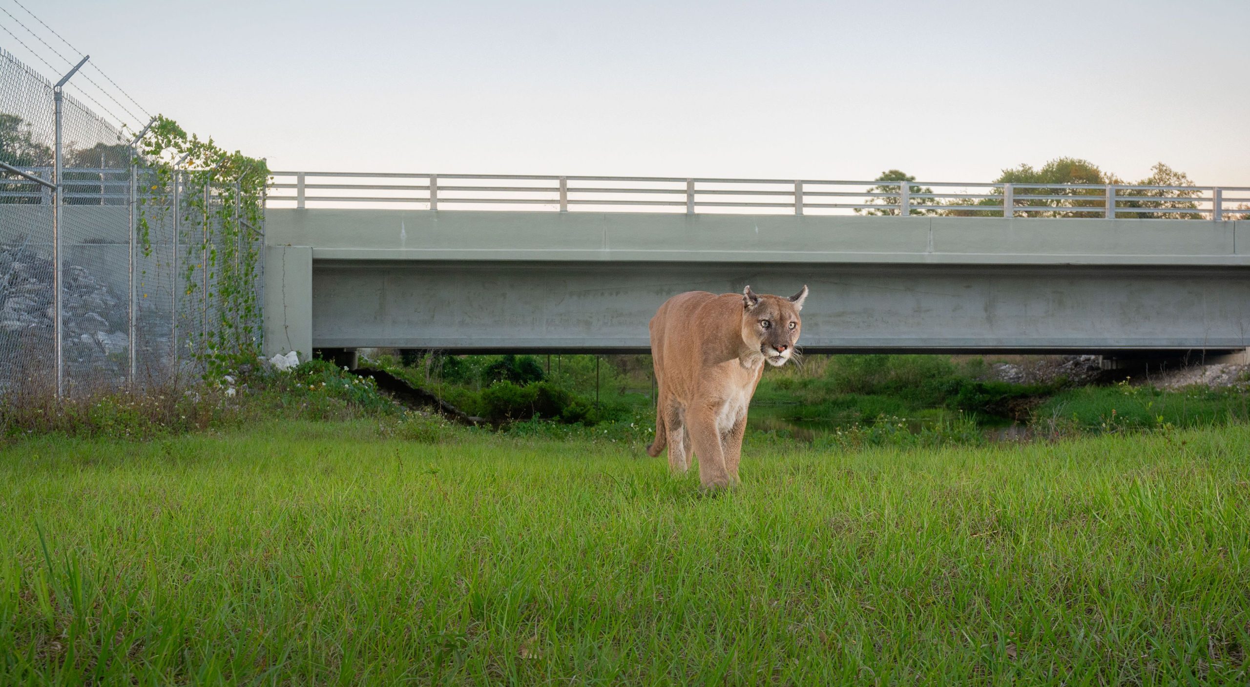
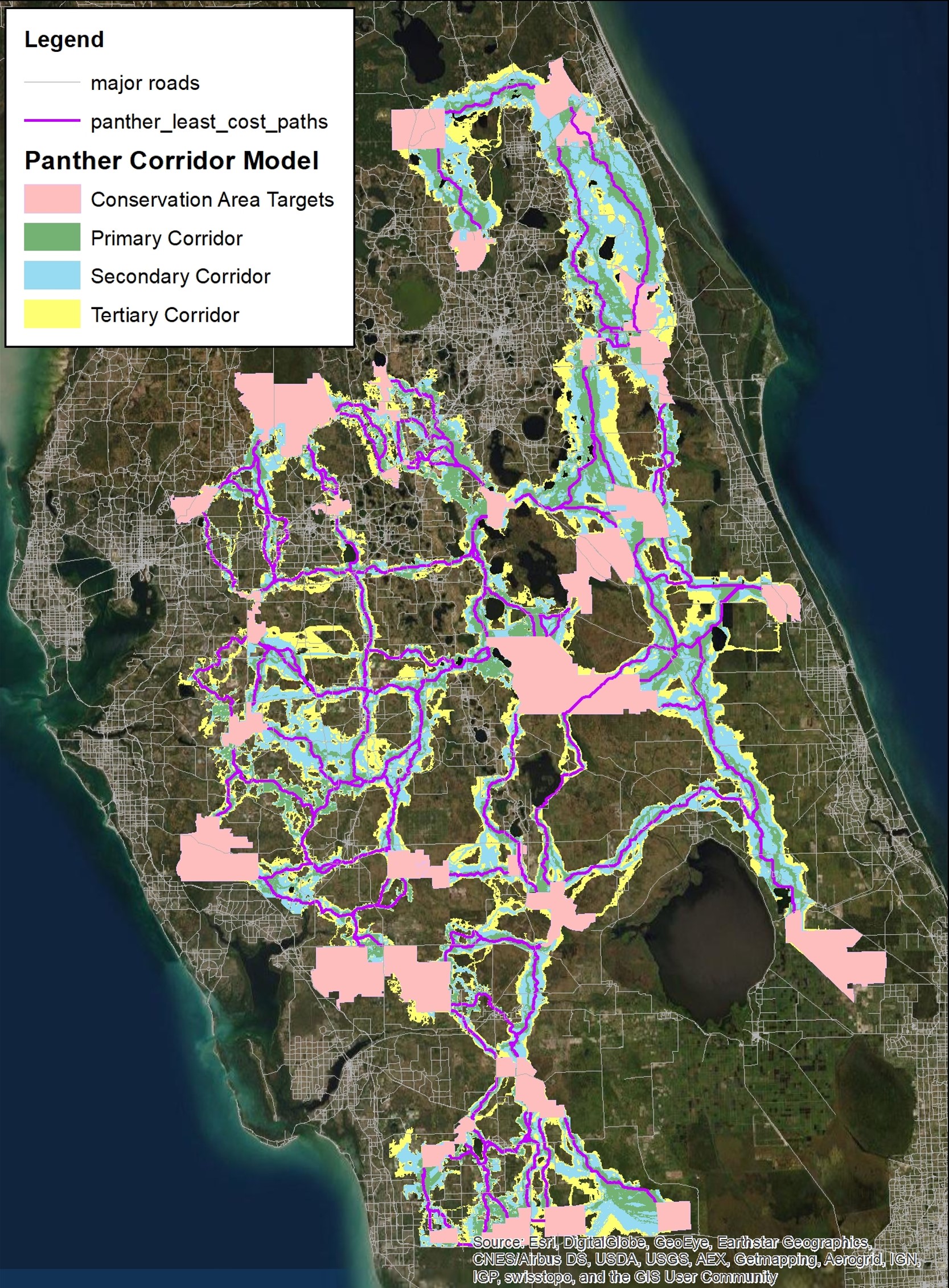
Predicting Florida Panther Movements and Potential Road Crossing Locations within South-Central Florida
(Include introduction to the Predicting Florida Panther Movements and Potential Road Crossing Locations within South-Central Florida project)
Project Objective:
Identify potential pathways and corridors that panthers are likely to use under existing land cover/land use conditions from the current species core range to large habitat hubs north of Interstate 4. Predict panther movements and natural range expansion within the south-central Florida region and identify probable road crossing locations.
Methods:
We used Least Cost-Path (LCP) and -Corridor (LCC) functions in ESRIs ArcMap 10.8. 1) FWC Cooperative Land Cover and FWS 2012 Panther Habitat Assessment Methodology Classification was used to identify land cover type preferences for panthers. The original 192 land cover classes were consolidated into 17 classes closely corresponding to the FWS classification categories. 2) We selected 34 target areas within the Florida Ecological Greenways Network.
Results:
Overall, 86% of the predicted corridors overlap with existing conservation lands or the FEGN. The primary level corridors consist of 94% existing conservation lands or the FEGN. There were 236 road segments (potential conflicts) identified that intersect least cost paths and 227 bridges (crossing opportunities) within ½ mi. We found that 67% and 84% of panther and bear telemetry locations, respectively overlapped with the corridor results. Eighty-three percent of panther-vehicle collisions and 81% of confirmed panther sightings occurred within ½ mi of the corridor model results.
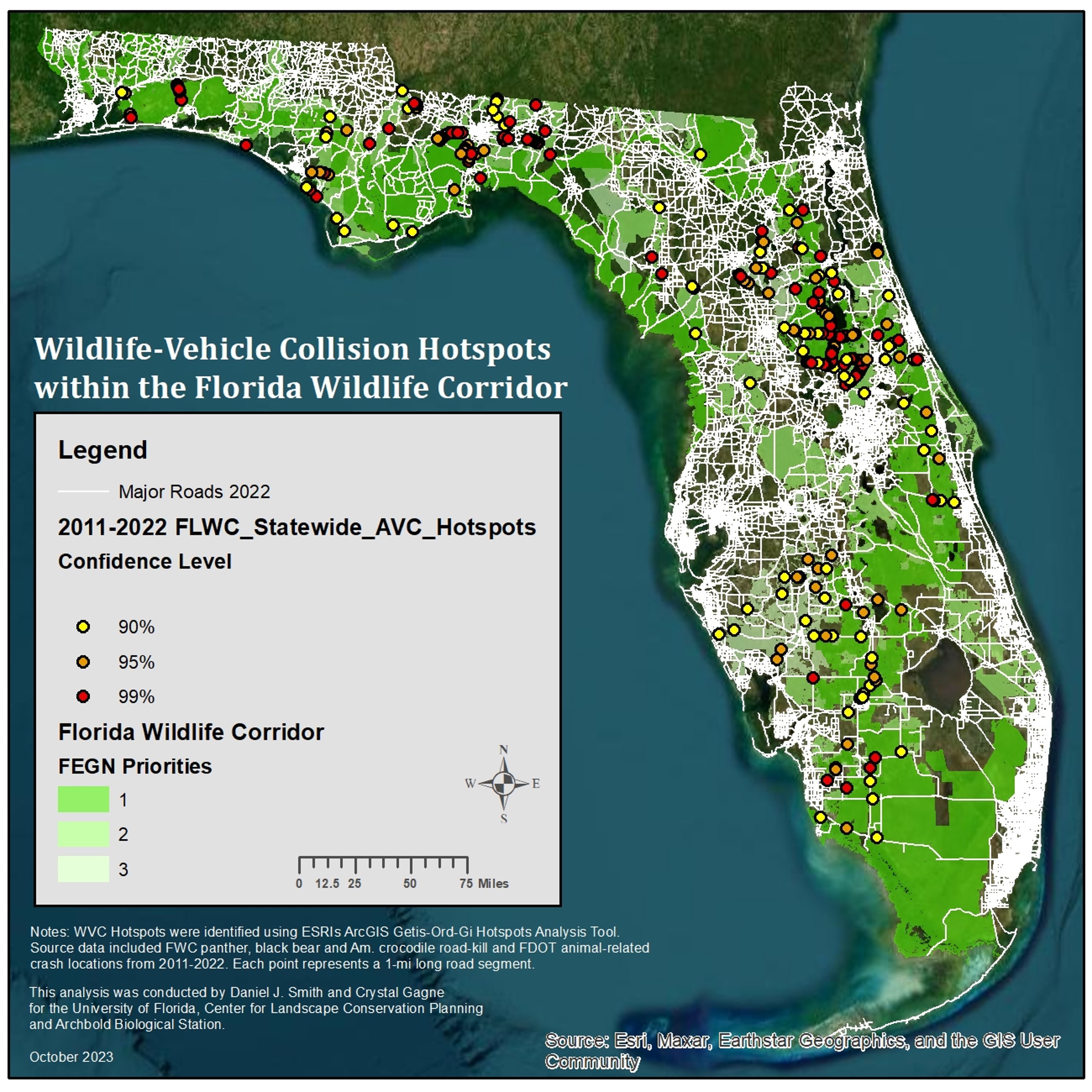
Large Animal-Vehicle Collision Hotspot
(Include introduction to the Large-Animal Vehicle Collision Hotspots Project)
Project Objectives:
1) Identify AVC hotspots on major Florida roads within the Florida Wildlife Corridor
2) Create a data layer for use in transportation project planning occurring within the Florida Wildlife Corridor.
Data and Methods:
- Based on existing data of animal-vehicle collisions
- Black Bear, Florida Panther, American Crocodile and animal-related accident reports
- Utilized Getis Ord GI* statistic in ArcGIS to identify three levels of significance
- Assesses probability of a road segment having a significantly higher-than-random proportion of observed collisions
- Confidence levels of 99%, 95%, and 90%
- Unit of measure: 1 mile road segments
Results:
•246 total hotspots; 104 hotspots at 99% confidence level; Highest # of hotspots in Districts 1 (84) and 3 (73)
•Hotspot layer tables include road and traffic characteristics and segments associated with conservation lands or proposed road projects