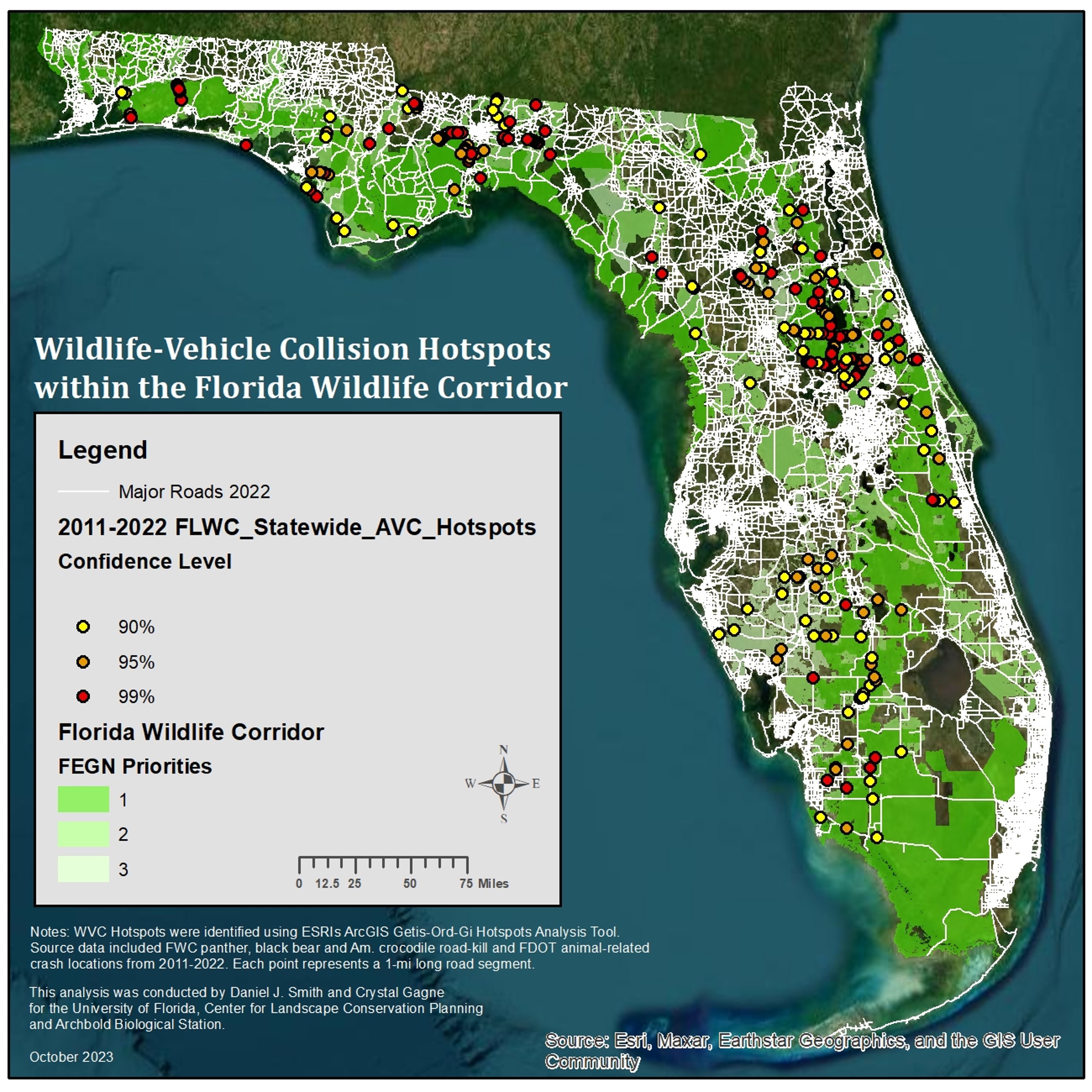
Large Animal-Vehicle Collision Hotspot
(Include introduction to the Large-Animal Vehicle Collision Hotspots Project)
Project Objectives:
1) Identify AVC hotspots on major Florida roads within the Florida Wildlife Corridor
2) Create a data layer for use in transportation project planning occurring within the Florida Wildlife Corridor.
Data and Methods:
- Based on existing data of animal-vehicle collisions
- Black Bear, Florida Panther, American Crocodile and animal-related accident reports
- Utilized Getis Ord GI* statistic in ArcGIS to identify three levels of significance
- Assesses probability of a road segment having a significantly higher-than-random proportion of observed collisions
- Confidence levels of 99%, 95%, and 90%
- Unit of measure: 1 mile road segments
Results:
•246 total hotspots; 104 hotspots at 99% confidence level; Highest # of hotspots in Districts 1 (84) and 3 (73)
•Hotspot layer tables include road and traffic characteristics and segments associated with conservation lands or proposed road projects