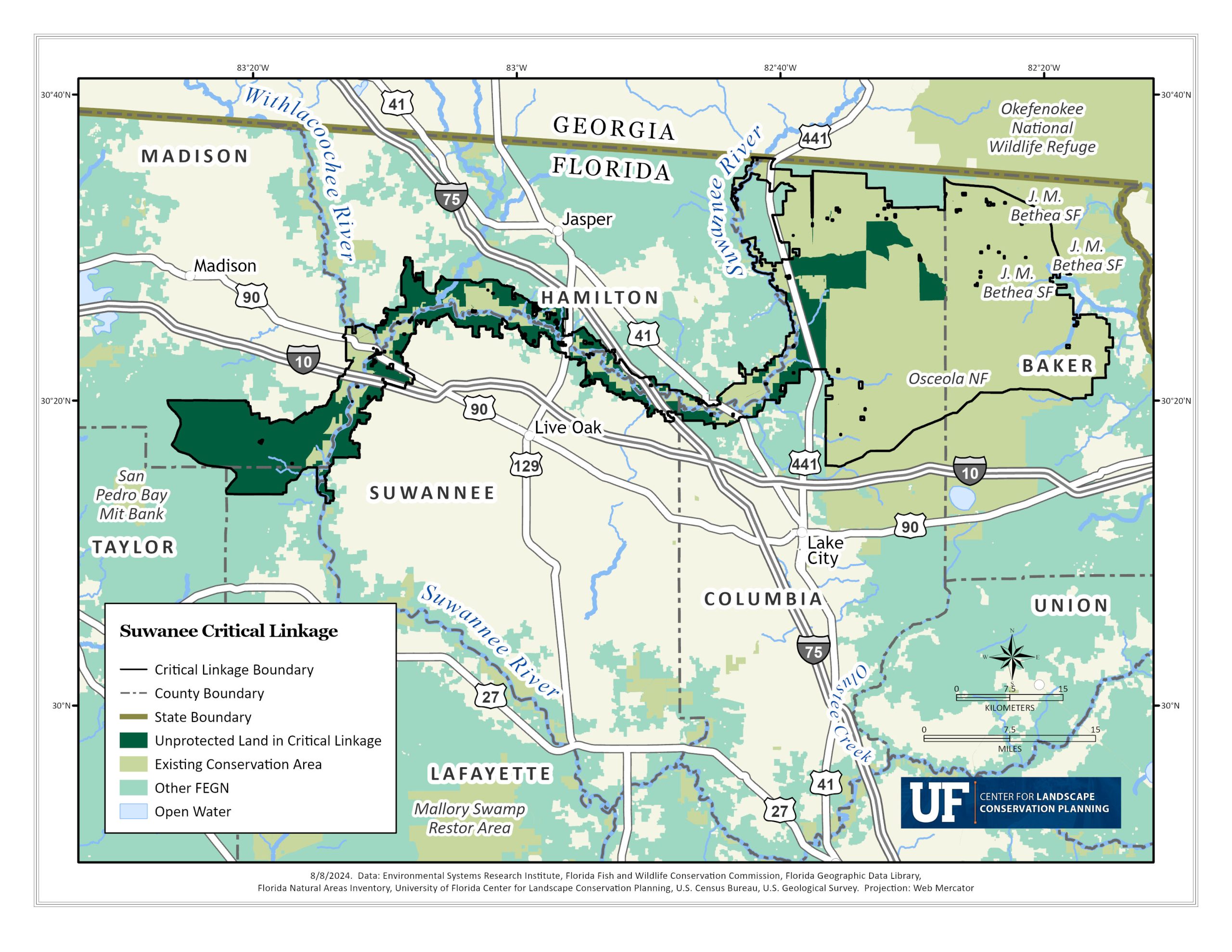
The Suwannee River Critical Linkage
From the Okeefenokee Swamps of Georgia, a river runs south into rural North Florida. This wild blackwater river winds for almost 260 miles through hammock and hardwood, fed along the way by swamps and springs, and eventually blends into the salt marshes along the Gulf of Mexico. This is the Suwannee River; a river rich with Florida, history stories and lore. The Suwannee River critical linkage is a “bottleneck” for the FEGN, which means it includes a narrow, sole connection opportunity between priority 1 lands in peninsular Florida and the Florida panhandle. Regionally, it would provide a sound wildlife corridor from Osceola National Forest to Twin Rivers State Forest as well as protect vital floodplains and rural lands that provide benefits for the river downstream as well as ecosystem services for the communities in the area.
The Suwannee River region is almost entirely within the Ocala Karst Geomorphological District, a region identifiable for its varying karst features such as sinkholes, springs, caves, and abundant limestone outcrops. Over 300 springs have been documented within the Suwannee River Watershed, and it thus has one of the highest concentrations of freshwater springs in the county. In addition, over half of the state’s thirty-three first magnitude springs provide water for the river. The Suwannee has carved its way through limestone over millions of years, and most of the upper river region within critical linkage is contained by these iconic limestone banks. Limestone formations not only have shaped the karst features of the landscape, but have influenced natural habitats, hydrology and human land uses. The Cody Escarpment, the shoreline of Florida from millions of year ago, runs through The Suwannee River region and influences much of the characteristics of the river. The upper Suwannee region, within the critical linkage, is characterized by clay soils that do not easily drain, a direct contrast to the well-drained sandy soils within the middle Suwannee River after the Cody Scarp. The source of water also shifts; uphill of the scarp the Suwannee is supplied mainly by surface waters, whereas groundwater becomes the main source as topography drops lower to the karst limestone.
These characteristics of the region have led to a rural, agriculturally dominant landscape uphill from the banks of the Suwannee. However, agricultural runoff and septic leaching contribute to a water quality threat for the river; an increased level of nitrate water pollution. Development pressures are also on the rise, threatening rural land such as timber plantations that are essential parts of the rural economy as well as Florida Ecological Greenways Network and Florida Wildlife Corridor and make up approximately 50% of land unprotected in the critical linkage is pine plantation. These timberlands provide ecosystem services such as timber production, carbon sequestration, wildlife habitat and corridors, as well as surface water infiltration and land stabilization. These landscapes can be restored into more natural ecosystems, such as original longleaf pine habitat; which would greatly benefit the preservation of this narrow corridor and the health of the river ecosystem. A challenge for the protection of the Suwannee linkage is the fragmented landscape consisting of mostly small, privately owned parcels. Collaboration with these small landowners to find solutions for conservation is essential for the success of the linkage.


Unprotected Land Cover Maps for the Suwannee River Linkage
The future of the linkage is dependent on the protection of currently unprotected land within this FEGN / Florida Wildlife Corridor priority one region. These maps provide a breakdown of the types of unprotected land cover in the Suwannee River linkage.